
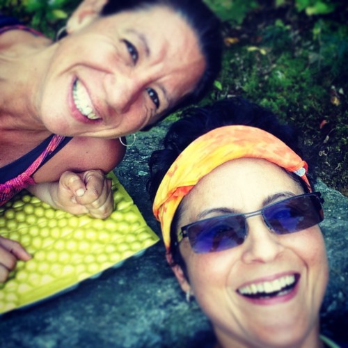
Drip and Hilltackler’s weekend adventure
This past weekend my friend Trudy “drip” and I planned to do a section hike of the AT starting from Salisbury Route 41 to Dawn Hill Road, approximately 24 miles over two and a half days. This wouldn’t be a conventional start for me, I usually start trips in the early morning or at least sometime in morning but I really wanted to knock out these miles to move closer to finishing off CT. Drip had to work until early Friday afternoon and If we met by three and did the car shuttle we would be at the start point in Salisbury by 4-4:30, giving us plenty of daylight to take the fairly easy walk to the Limestone Lean-to. That was the plan but Drip was detoured by severe traffic and was forced off the highway to the country roads with the rest of the travelers. In the end we met up and parked Drips’ car at the endpoint around 5:30pm. We then hopped in my car and drove to Salisbury excited and ready to start our adventure! The weather was forecasted to be beautiful and almost summer like for our section hike. Stoked! As we set off on the AT heading southbound we knew that we would only have about an hour or so of light left and we would have to hike part of the way in the dark by the light of our headlamps.

Before this weekend’s trip there had been a lot of talk of bears. A man in New Jersey was tragically killed by a black bear while out hiking with his friends the previous weekend. As experienced hikers we understand that this incident is very infrequent but still can play with your mind, especially in the dark! At least for this hiker. Put that together with all the talk of bears on the evening news, social media, and the hiking groups and forums I participate in online – it was bear mania! Everybody had a story! With all this in mind and the fact that Drip and I would be hiking in the dark we talked loud and every so often would clap our hands. We had a lot of fun following the trail by the light of our headlamps.
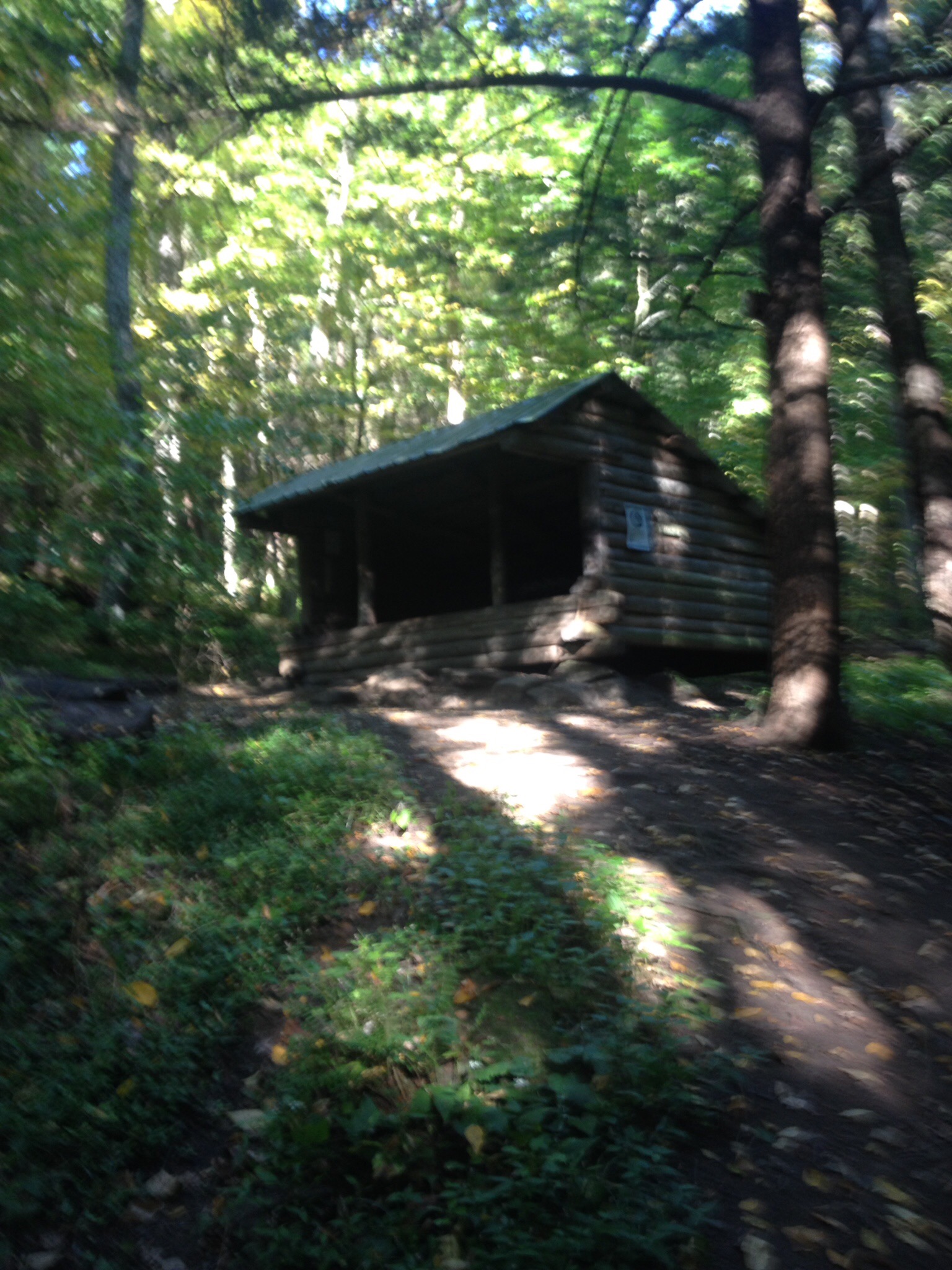
Limestone Shelter in the light of day!
The section of trail leading to the Limestone shelter area is fairly flat and we made the blue blazed side trail by 8pm. The footing gets a little steeper and rockier as we descended to the shelter area. It was then we discovered that the keys to our car at the end were in the glove box of my car back in Salisbury. Somehow this didn’t seem to bother either me or Drip. That’s the thing about backpacking…it’s best to stay flexible, plans often have to change based on circumstances such as injury, weather or mistakes. As Drip and I set up our hammocks we both agreed that the best plan was to hike back to the car and move it further along on Route 7 and then continue the hike to the Sharon Mountain campsite. This cut out five miles or so but that would keep us on track for getting to our end point on Sunday.
So we hiked back to my car on Route 41, often noting how different things look in the day time. We met a south bound thru hiker “The Clark” and his dog “Pistol Pete”. They were quite the duo. The Clarke had already section hiked the AT over 14 years and decided this year to thru hike the entire trail. It was nice to run into a thru hiker and chat it up for a couple minutes. As Drip and I continued on we took in the views we missed, due to darkness, on the way up the night before so we stopped and soaked in the views on the way back down.
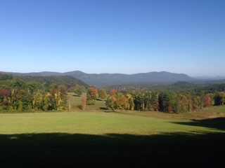
We arrived at the car – secured the car keys – and headed to the parking area along route 7 and jumped back on the trail and headed towards Sharon Mountain campsite. We only had a couple miles to go so we took our time and enjoyed the trail. This section of trail doesn’t have too many views but the best of the day was Hang Gliders View where we took a long snack break.

View of the Day! Hang Glider Veiw
Drip and I got to the Sharon Mountain campsite around 4pm. It’s a nice site with plenty of tenting areas and usually a good water source. I knew going into this trip that water sources along the way would be scarce. I’m a regular reader and poster on Whiteblaze a hiking forum dedicated to the AT and other long distance trails. During the week I had inquired about the section Drip and I would be on and most people who had been through there lately had mentioned the lack of water. Luckily we had a nice sized puddle to pump out of, after the frogs hopped away. I carry a sawyer squeeze and the thought of pre-filtering while I was so thirsty was unappealing but Drip to the rescue with her Katydin hiker pro pump! Clean water for all!

The Clarke & Pistol Pete
As we settled into our home for the night, The Clark and Pistol Pete came down the trail. Unbeknownst to us this was their destination for the night too. The Clarke had started south bound from Maine a couple months prior. He was enjoying the easier terrain of Connecticut and getting in more miles every day. Going south bound on the AT is a different experience than doing the usual northbound hike, more soliltude but The Clarke seemed to enjoy that aspect of his journey. We sat around camp as darkness came and chatted about the trail, life and our names in the real world. Pistol Pete napped in the cool dirt. Before turning in for the night, we offered The Clarke to share our bear rope, so me, Drip and The Clarke walked down the trail with Pistol Pete leading the way to hang our food. We all went back to camp and said our good nights. I climbed in my hammock and drifted to sleep quickly. Tomorrow would be our longest day of the weekend, 10 miles.
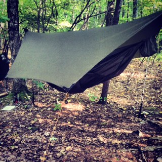
Warbonnet Blackbird Hammock
We got an early start on Sunday, our last day, on the trail and began hiking by 8:30 a.m. Drip and I planned to hike a steady pace for the six miles to the Caesar Brook Campsite where we would have lunch and fill up on water before banging out the last four miles back to the car. I planned to have Friday night’s dinner as my lunch. Not my usual practice but I was hungry and didn’t think another protein bar was going to cut it so I fired up the Jetboil. A lunch of sustenance was needed!
While the AT in Connecticut isn’t very steep, it is bumpy! The trail loses a couple hundred feet of elevation every time you hit a road only to have to climb back up…all day long.

Drip in Split Rock
Drip and I packed up and headed down the trail for the last four miles back to the car talking about our post hike food. We reached the car around 4 p.m. After picking up my car we stopped in Cornwall and grabbed a great burger before we parted ways and of course talked about our next section hike of the AT!
